Ray's Corner
![]()
![]()
![]()
![]()
![]()
![]()
![]()
![]()
![]()
![]()
|
Ray's Corner
|
|
Ten Days on the Thelon
– A Narrative –
Paddling in Celebration of the Thelon’s Second Century as one of Canada’s
Great Recreational Rivers
Introduction:
The Thelon River traverses for some 850 kilometres across what is now Canada's redefined North West Territories and the mainland portion of Nunavut. The Thelon River drainage basin is 142,400 square kilometres in area and stretches 650 kilometres east-west and 500 kilometres north-south. About 75% of the drainage basin lies south of the river, extending all the way to the northern boundaries of Manitoba and Saskatchewan. The river proper rises at the edge of the tree line 175 kilometres east of Great Slave Lake and flows easterly, gathering strength from large tributaries that rise to the south, and eventually, after some expansion and loitering in four lakes along its downstream course, empties into Chesterfield Inlet at the north end of Hudson Bay. The Thelon is somewhat unique in terms of Arctic tundra rivers in that its central section has copious amounts of black and some white spruce hugging the shore line and retreating inland up the low lying valleys of the feeder creeks. This area has been described by some writers as an "oasis" of boreal forest within the harsh tundra environment, and has become a natural haven for wildlife.
Map of the Thelon River after Wikipedia (The section described herein lies between Hanbury River and Beverly Lake)
The Thelon was the last of the large Rivers of Canada to be "explored", its first longitudinal traverse being upstream in 1899 by the British explorer Hanbury, after which one of the Thelon's major tributaries has been subsequently named. Its uniqueness was early promoted, and recognized with the establishment of the Thelon Game Sanctuary in 1927 by the Canadian government. The prime intent of the sanctuary was to protect Canada's southern-most congregation of musk oxen which eked out an existence along the north shore of the river. Its creation has also had a beneficial effect on what has since become known as the Beverly caribou heard, which in its migration cycle crosses the Thelon twice annually (or is supposed to!).
The Thelon became part of the Canadian Heritage River system in 1990.
The objective of our 10 day expedition was to generate a tundra river experience for three 50-somethings who had spent most of their working lives with Ontario's Ministry of Natural Resources in the boreal and/or Great Lakes-St. Lawrence forest environment. Bill, although a war baby born in England, had been raised in Chapleau, and had spent his entire career in Ontario's north, originally in the enforcement business and latterly on the management side of the organization. He had taken early retirement and was involved in consulting out of Sault Ste. Marie, Ontario. John, a biologist and of American Great Plains extraction, had been a distinguished purveyor of his trade who gradually moved into the Ministry's management ranks and was presently working out of the Peterborough Main Office as Manager of Enforcement. Ray, a geologist, had been brought up in Nova Scotia's Acadian forest environment, and was now in the consulting business after retiring from MNR's executive ranks. The last member of the party was Bill's cousin Chris, a life long resident of London, England who was running his own water softener business northwest of that megacity. Chris's exposure to the Canadian wilds had been on a goose hunt to Moosonee, a deer hunt in Nestor Falls, and a few day fishing trips out of Cochrane and Sault Ste Marie. He would get more!
Since our threefold stated intent was to experience the tundra, to see wildlife, and to catch fish, and all in a ten day period, we were advised by several outfitters that we should consider the central part of the Thelon from Warden's Grove to Beverly Lake through the center of the Thelon Game Sanctuary. Given the fact that we were of the age where we no longer felt the need to prove our manhood by severely taxing our 50-something bodies with multi-kilometre portages or forty day excursions, the central portion of the Thelon appeared to fit the bill and we booked on.
The Beginnings:
Bill and Ray arrived at Yellowknife on the late evening of July 6 and were met at the airport by the outfitter's representative who shared some information, provided us with some forms, and confirmed that all was set for access to the Thelon on July 8. Our concern at that particular time had been for a potential strike of Air Canada employees which had the potential to close the airline down at midnight on July 7. While the two of us were already securely ensconced in Yellowknife, both John and Chris were scheduled to arrive on July 7 and might run into problems if the strike was activated. To our good fortune it was announced on the evening on July 6 that union members had ratified a tentative agreement with the company and a strike was averted.
Bill and Ray spent most of July 7 doing the tourist thing in Yellowknife, and in addition they picked up a satellite phone designed for emergency communication. Told by the lessee to ensure we had recharged the battery, we returned to our hotel room in late afternoon and put the unit on recharge. A call from John indicated he had misses his afternoon plane into Yellowknife and had rebooked on the evening flight, the same flight on which Chris was booked.
At 9.30 p.m. the outfitter's office called informing us that instead of flying in on the evening of the 8th as originally planned, they would be picking us up at the hotel the next morning at 7.00 a.m. for an 8 a.m. departure. Discussion ensued that we had been working on the 8 p.m. departure and could not be ready at the designated time due to the need to pick up last minute items such as fishing licences and fresh food. We sawed off on a nine o'clock pickup at the hotel and some vehicular assistance in getting around town doing our last minute shopping. An hour later in the hotel lobby, as we noted that John and Chris had not arrived at the hotel from the airport at the prescribed time, we were getting ready to call the outfitter and postpone the flight until later the next day. However, they finally arrived, only slightly the worse for wear, after a late departure from Edmonton. After a quick exchange of information and a nightcap, we all turned in anticipation of an early start the next morning.
The morning of July 8 dawned clear with the anticipation that the called for 220 C temperatures would be realized later in the day. Our ride arrived on schedule and deposited Bill and John at the supermarket while Chris and I acquired the necessary fishing licences from the Tourist Information Center, and some selected hardware items, including stove fuel and 12 gauge plastic slugs for our grizzly deterrent.
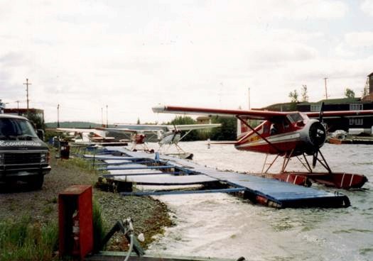
After completing the necessary cash transaction to finalize the agreement with the outfitter, our loaded standard Beaver cast off from the dock at precisely 10 a.m. A warm up and a short taxi run later saw us airborne and banking over the Oldtown section of Yellowknife heading toward the east end of Great Slave Lake. Our flight
Air Thelon’s Base at Yellowknife’s ‘Oldtown’
was to be completed in two parts. The first segment of about 2.5 hours duration was to take us to the outfitter's base camp at Whitefish Lake. After a stop for fuel and a briefing regarding the river and some trip logistics, the second segment of about 1.5 hours would deliver us to Warden's Grove on the Thelon.
The flight to Whitefish Lake was generally uneventful and only about 2 hours due to a stiff tail wind pushing us along at up to 110 knots. It gave us a good chance to accustom ourselves to the terrain. From about 2500 feet the area immediately east of Yellowknife was not unlike the shield country north of Red Lake, given a substitution of jackpine for spruce. The ruggedness of the northeast arm of Great Slave, highlighted by cliffs some several hundred feet in elevation, displayed a strong resemblance to the Thunder Bay area. The spruce forest gradually became sparser until about 30 minutes from Whitefish Lake we found ourselves flying over treeless tundra. We saw two separate musk ox bulls grazing on the willows at the tundra forest interface.
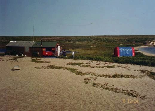
Air Thelon’s Whitefish Lake Photography Camp
The Whitefish Lake camp is situated on the shore adjacent to a large sand esker complex. The location was chosen specifically for its wildlife photography opportunities. The esker provides good denning capabilities for foxes and wolves, and the numerous anastomosing trails in the tundra suggest the area experiences a significant caribou presence during migration. The camp is best described as rustic, with clientele accommodation in six, plywood-floored, partitioned, Quonset-style tents that will together sleep up to 24 guests. Staff and pilots bunk in either an office/library attached to the cookery, or in temporary expedition tents. Finishing off the camp complex is a good privy system (a value determination by our "Queen's Representative" after 11 days on the river with something of a loose bowel), and a shower facility. Aircraft are moored on the beach in a protected little cove on the edge of the esker complex some 150 meters northwest of the camp. A collection of photographs by photographers from across North America and Europe maintained at the outfitter's Yellowknife headquarters attest to the success of the location and the operation in its quest to match photographers with arctic fauna and flora.
After taking on fuel and a quick briefing on the river, in particular as to location of pickup some 11 days hence, and our agreement to cover extra fuel costs resulting from our being over our collective weight allowance, we were again airborne over tundra and winging towards Warden's Grove. About 20 minutes southeast of Warden's Grove we spotted a heard of up to 300 caribou feeding on a ridge about a mile away to the northwest. Minutes later, on the southeast side of the aircraft, another 50 or so came into view, likewise heading northward. And then there was the river! We landed and taxied up to and moored on the beach below four canoes cached the previous fall in the willows above the high water line.
The River:
The Thelon proper issues from Lynx Lake and hurries some 875 kilometres east and northeast before spilling into Chesterfield Inlet. As a canoeing river the Thelon is conveniently divisible into three sections. The Upper Thelon drops about 100 meters over a distance of some 200 kilometres from Lynx Lake to the junction of the Hanbury River. This section of the river tends to be alternating fast and slow flowing with a variety of white water challenges to be run, lined, or portaged depending upon water levels. About 20 meters of the vertical drop is captured through the Thelon Canyon, about six miles upstream from the junction with the Hanbury. The eastern Lower Thelon is some 250 kilometres long from Beverly Lake to the west end of Baker Lake and the Inuit community of the same name where most trips terminate. This section is highlighted by the presence of three large lakes, in order west to east, the aforementioned Beverly, Aberdeen, and Schultz. These lakes tend to be shallow, and frequently wind-buffeted, and provide a significant challenge for the paddler going through to Baker Lake. Being wind bound for several days on this passage is not uncommon. This section of the Thelon also contains its largest tributaries, the northerly flowing Dubawnt and Kazan Rivers.
The section of the river traversed by these adventurers, the Central Thelon, covers some 300 kilometres between Hanbury Junction and Beverly Lake, dropping some seventy meters over that distance and flowing along at about five kilometres per hour. It is variously from a quarter of a kilometre to a kilometre or more in width; depths range from half a meter in its shallower sections to in excess of three meters in the deeper sections. For the most part the bottom is not visible although the water is generally clear enough to allow visibility to about a meter and a half. There are no portages in this 300-kilometre stretch and, with the exception of a few standing waves in narrow and shallow stretches, no significant areas of difficult water. Remember to stay on the south shore when going through the Thelon Bluffs to avoid the standing waves against the outcrop on the north shore. Gravel bars are common in and along both shorelines on many sections of the river.
Shorelines along the river are frequently active, either eroding or receiving sediment as the river snakes along its course. Shoreline areas where energy levels tend to be low, such as in the vicinity of the creek from Cosmos Lake, show the growth of willows right out to water edge. Water levels during July of 1999, according to guides on the river, were apparently about one meter higher than average. High water levels as depicted by willow-free rocky shorelines were estimated to be about two meters higher than existing water levels at The Gap, with flood levels, estimated by ice damage to trees, at an additional two meters. Further downstream at Ursus Islands the flood line appeared to be about five meters and the high water mark about 2.5 meters above the existing river level. Two photographs in the Canada Water Resources (CWR) cabin just west of Thelon Bluffs most surprisingly confirmed that the Thelon passes much water. Those photos, taken on May 9, 1991, show the river level to be within a foot or so of the door of the cabin, estimated to be some 15 meters above the July 17/99 water level. CWR notes in the cabin indicated the measured level to be in excess of 32 meters (above what standard??) and the volume of water in excess of 4000 cubic meters per second, or as some wag had subsequently added to the CWR note, the approximate equivalent to eighty 18-wheelers passing every second.
The geomorphology of the river is likewise somewhat variable along its Central section. The river from the junction of the Hanbury to the point south of Cosmos Lake tended to be rich in a white to buff sand, glacially derived from local reddish buff sandstone. The section of the river from Cosmos Lake to approximately Hornby point generally trended northeast, had copious amounts of spruce along both banks and up the creek mouths, and again except for the lazy "S" turn a few kilometres upstream from Hornby Point, below normal water velocities. The canoeing experience through this section was not unlike that on some of Ontario's north-flowing rivers. Below the islands northeast of Hornby Point the spruce forest becomes increasingly intermittent, such that by the time the Ursus Islands are reached black spruce is represented by only a few widely scattered, small patches of weather-beaten trees.
With the exception of The Gap, bedrock first becomes a significant feature of the shoreline at the river's 90-degree turn to the east below Hornby Point. This abrupt change in direction was itself caused by the presence of some gently dipping sandstones on the river's north shore, their ledges above the waterline interestingly still partly covered with ice when we passed on July 12.
North Shore Sandstone Below Hornby Point
Bedrock continues to occur along the river, although increasingly intermittent, all the way to Thelon Bluffs. Most of the outcrops exposed by the river tend for the most part to be low lying, rarely more than 10 feet above the water level, and frequently just barely exposed in the bank at the gently sloping waterline. Overburden was typically a reddish sandy till and ranged from a few meters to 150 meters in its thickest sections.
On the upper end of the river buff-colored sandstone made up the most of the cobbles and boulders on the rocky shorelines and islands. Cobbles and boulders of a light grey, frequently stromatolitic, limestone become a significant portion of the beaches through its middle section, causing the overall cast of the beaches to change from reddish tinge to more of a light grey. Stromatolites, by the way, are fossils of organisms found in limestones throughout the geological column, and the most common fossil in Precambrian rocks. In vertical view they would resemble a slightly distorted cross-section of a large onion with a slight separation between individual layers. About one hundred kilometres from Beverly Lake a dark red pebble conglomerate makes its increasingly frequent appearance in the cobbles and boulders along the river, becoming very common in the area of the Thelon Bluffs.
Typical Cobble River Bank at Camp Seven from which Musk Ox and Wolves were Observed on the Far Shore
The more permanent islands in the river may be covered by black spruce, a mixture of spruce and willow, or simply willow. Where they are undergoing active erosion they commonly display alternating narrow layers of buff colored sand and black organic material capped by a couple feet of organic material. This suggests that these islands represent the remnants of an earlier river bottom and that more recent isostatic uplift of the area has caused the river to find a new and stratigraphically lower level. Interestingly, with the exception of the islands, layered organic deposits were not observed in the overburden exposed along the river's active shorelines.
The Routes:
Longer canoe trips in the Thelon basin generally follow one of three upstream routes, all of which coalesce about 10 kilometres upstream from Warden's Grove. From there the Thelon is generally pursued to either Beverly Lake or the community of Baker Lake. The first is the physically challenging Hanbury to Thelon route that generally begins at either Artillery or Sifton lakes, and is characterized as arduous due to the need for long portages around a number of falls and canyons 25 to 30 kilometres upstream from its confluence with the Thelon. The second is the upper Thelon route which begins at Lynx Lake, or alternatively downstream at Eyeberry Lake, and which has significant white water and also a significant portage of several kilometres around the Thelon canyon about 6 kilometres upstream from the confluence with the Hanbury. A favorite early season route into the Thelon is via the Clark River. Canoeists on this route can experience three to four days of good whitewater opportunities before settling in on the portage-free Central Thelon. It also provides an opportunity to better experience the Thelon's black spruce "oasis" by arriving from, and returning, to the tundra.
The logbook in the CWR cabin was instructive from the perspective of the nature of some of the journeys pursued by some of the Thelon-focused canoe parties. One party undertook the Thelon experience over 40 days by canoe directly from Yellowknife, paddling the full length of the Great Slave Lake to Reliance, through Artillery Lake, over the height of land, and thence downstream via the Hanbury to the Thelon and eventually to Baker Lake. A number of other slightly less energetic parties began their canoeing venture at Reliance on Great Slave's northwestern end.
The South Shore Campsite at Wardens Grove
Interestingly, a couple parties began their excursions in Northern Saskatchewan, which, particularly in times of low water, can be extremely challenging of the canoeists physical abilities.
The Warden's Grove to Beverly Lake section of the Thelon was when we canoed it estimated to be about a meter above July normals. Campsites were generally available along either the rocky beaches or, where there was no black spruce, above the beaches on the exposed bank tops. These latter sites had the benefit of wind exposure which greatly assisted in managing the flies. Their downsides were the climbs that were required to get gear in place, and the off chance that severe winds might cause damage to the highly vulnerable, exposed tents. We used them twice with the rest of the campsites on the shoreline beaches, most frequently the south shoreline to allow us to take advantage of prevailing northerly winds as a fly deterrent.
Thelon weather is best described as highly variable. Temperatures ranged from the about 50 C to the low 20's, and were consistent with normal means. Winds, which were almost always blowing, although sometimes tending to let up during the early evening, were for the most part out of the north (yes, generally into our faces!), with frequent excursions to the northeast and northwest. Velocities probably averaged 20km/hour during the day, although at least twice we faced headwinds of 35 to 40 km/hr. and for a five-hour period one evening they certainly exceed this figure during a storm. Winds were on our back only on our first and last days on the river. We had thunder and lightning, occasional rainstorms and driving cold showers, full sun to partial sun to heavy cloud cover, and one socking good storm that blew in from the north one evening with heavy winds and rain. The eastern horizon often appeared to be more weather friendly than the western, with beckoning broken cloud and patchy blue sky contrasting with heavy dark cloud and rain to the west
The Flies:
Other hardy northern travelers had suggested we should prepare for an insect infestation much worse than those we'd experienced in Northern Ontario. They were right!! Only once had I seen similar hoards in Ontario and that was one afternoon in the early summer of 1972 in the Hudson Bay Lowland. The Thelon River flies were a mixture of mosquitoes and black flies, with only the occasional inconsequential horse fly thrown in for good measure. Given appropriate conditions both abundant varieties could be found throughout the day. However mosquitoes, as would be expected, tended to be more prevalent after the sun went down or during cloudy periods with high humidity. Black flies tended to be the king of the daytime, swarming particularly viciously under higher temperature conditions. Wind and temperature tended to be the best fly controls, with neither species being active during lower temperatures or under high wind velocities. Walkabouts on the tundra were interesting in that as long as one was walking into the wind one would appear to be relatively fly-free. But turn around and walk with the wind and the hoard of flies that had been using one's body as a moving windshield would instantly and savagely attack. Attacks would also be standard fare if one walked into a hollow or swale between ridges where the flies were protected from the wind.
Prior to the trip your scribe had been having a running debate with himself about how he should prepare for the Tundra fly experience - Would it be worse than expected? Would he need a bug hat? What about a bug jacket? What kind of fly dope? In the end he elected to go in with two (one spare) pullover head nets and a supply of Muskol. It turned out to be the right choice. The pullover headnets could be easily removed or folded up inside his regular Tilley-style hat. The two bug jackets (different styles) that were used by other members of the party, although they did the job, proved to be a bit too cumbersome and, not infrequently, hot. Beyond the headnets he wore a long sleeve shirt to protect his arms, a sweatshirt to keep flies from going in between the buttons and decimating his chest. During the day he kept his pantlegs in rubber boots, and in socks held up with elastic bands in camp. Fly dope was applied as required. On the worst day, the warm day we arrived, he sprayed his face and head just to get the upper hand. While he was obviously bitten, the black fly bites were occasional and, due to significant exposure in early spring, left nothing more than a spot of dried, caked blood. Mosquitoes occasionally managed to find the target but left no telltale signs.
Unfortunately our "Representative from across the Pond' did not fare quite as well.
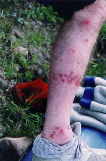
Chris’ Fly-bitten Leg Three Days into the Trip
The temperature on the afternoon we arrived at the Thelon was in the low 20's and was coupled with a light wind from the west. The black flies loved these conditions and immediately made their presence known as we set about getting ourselves organized and a campsite established. There was initially some notion that they were not much worse than would be expected under good conditions at home. However, after a couple hours we twigged to the fact that they were unusually persistent. At one point in time a conscious check of the state of 'Our Brit' to see how he was adjusting to the flies found him with his pantlegs tucked into his socks, and he was mentally awarded points for this farsighted action! But alas, in the initial hour the black flies had already done a real number on his legs, particularly his right, before he had had the presence of mind to tuck in the pantlegs. Two days later we counted 73, often coalescing, bites on his right leg below the knee, each marked by strawberry-red welts about 3 mm across. His left leg and hands had the same markings but had fared much better because of significantly smaller numbers due to liberal applications of Muskol. The bites gathered that first afternoon became something of a problem as his leg and hands tended to react by swelling, and he appeared to have been overtaken by a low fever. We had no antihistamines, but were able to administer some ibuprofen internally and cortisone cream topically. Although the red welts and associated minor itching stayed with him for several days, an eventual 'full Monty' bath in the cold river waters three days later provided the most apparent relief, dispersing the fever and reducing the swelling in both hands and legs.
The Daily Routine:
John, who had volunteered to be responsible for acquiring the food (just because, he admitted later, there was no way he wanted to leave the responsibility to Ray or Bill), also took on the cooking responsibilities. We knew he was good at it from demonstrations at the fall deer camp, and so there was no argument to him assuming those responsibilities, in fact there may have even been some slight sighs of relief. John's intentions were to get us on the water by 9.00 a.m. and to do so he established a getting up time of 6.30 a.m. Remarkably, this routine saw us on the water between 8.40 a.m. (it was raining and we used the gas stove) and 9.02 a.m.
One of the questions we had before we left was whether there would be enough wood to allow us to cook on a wood fire, or whether we would require gas. Ray's source indicated that wood would be a problem on the latter half of the trip and as a result we took along a single burner Coleman-type unit. What we discovered is that a party can indeed scrounge enough dead wood on the central section of the Thelon to cook over an open fire. There is an abundance of dead, dry spruce along the upper reaches of the river, and with judicious searching at flood level, abundant driftwood in the lower reaches. A layer of driftwood, primarily arctic willow, but containing occasional spruce from upstream, marked the high water level of Beverly Lake. We did carry firewood with us from about day five onward.
There is within the canoeing fraternity two schools of thought in respect of the question of campfires. The purist school tends to want to ensure the pristineness of the wilderness and perceives the footprint of a wood cook fire as intrusive and denigrating of their wilderness experience. One set of comments in the CWR logbook from a second-time party of two lads from the western US indicated their disgust at some campsites "….fireplaces and aluminum foil - ugh…" and that their experience had been lessened as a result. The voyager school, on the other hand, tends to treasure the comfort, the facility, and historic reality of the wood campfire and will use it wherever possible. While we wholeheartedly agree with the comments of our American friends in respect of the discarded aluminum foil, we do not necessarily share their values when it comes to the use of wood fires. When constructed on the active, high-energy beaches the longevity of the camp fireplace on the Thelon is at best one season because they are completely obliterated by the spring freshet. Those constructed above the high waterline however may be retained for posterity, and are best not created. We did on our trip see evidence of two abandoned fireplaces above the high waterline.
The basic food for the trip consisted of dehydrated, primarily preseasoned, pasta and rice, occasionally augmented by small cans of chicken or shrimp. These supermarket selections (along with dehydrated potatoes which we did not include due to a lactose intolerance imported with our British colleague) have become simply first-class trekking food over the past couple decades. Even the dehydrated eggs, which none of us had previously experienced, were given the Thelon gourmet mark of excellence. The dehydrated selections had been supplemented by a few days of fresh meat and eggs acquired in Yellowknife, part of which inadvertently fell prey to staff at the camp at Whitefish Lake when we stopped for gas and the briefing. Lunches consisted of GORP - a mixture of peanuts, raisins, and trail mix - topped off by a half (!) square of Baker's chocolate. Fish became a significant part of our diet after the second day and we frequently had grayling for breakfast and lake trout for dinner. For the most part the trout were back-filleted and grilled, skin down, over an open fire and were simply succulent. The grayling, either pan-fried or grilled whole, produced a white, sweet meat with a somewhat finer texture than either the trout or pike. Like pike, the grayling had an extra layer of bones to contend with, but these stripped out easily with the backbone after cooking. Pike were consumed early in the trip, were generally filleted and pan-fried, and lacked any hint of the muddy taste occasionally attributed to their cousins from warmer southern weed bed environments.
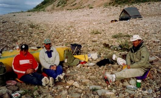
Relaxing after Dinner at a Typical Cobblestone Campsite (Note the jackets in July)
Coming off the river proved to be more of a challenge than getting on. By two thirty, and sometimes as early as two o'clock, Cook would be muttering about the need to find a campsite and held out the suggestion of 'happy hour' as an incentive to the rest of us. However, we had this challenge of canoeing 300 kilometres in 10 days, and that necessitated that we make at least 30 kilometres a day. A couple fishing stops in the morning, the investigation of a wolf den, and lunch, often saw us several kilometres short of our required distance by two thirty. In addition, there was a desire to get ourselves a bit ahead of schedule to allow us some flexibility if we became weather- or exploration-bound for a day. While we knew that, if necessary, daylight would allow us to travel well into the evening, we desired to avoid it if possible, in particular since Chris had a recently diagnosed vertebra problem and had difficulty with long days on the water. So practically every afternoon we'd find ourselves facing the tension of stopping early versus covering at least the minimum required distance.
With one significant exception we were usually off the water by 4.00 p.m., and never later than 5.30 p.m. The one significant exception saw us paddle until 9.45 p.m. with our destination focused on the CWR cabin just upstream from Thelon Bluffs. The previous day we had pulled off the water early, just after 1.00 p.m. Ray, the honorable yet perhaps somewhat lazy map-reader, had declared our location from his 1:250,000 scale maps to be ahead of schedule and just south of Ursus Islands. Consequently, an easy paddle of about 30 kilometres the following day would easily bring us to the CWR cabin. We would then have the option of exploring for a day from the cabin, or proceeding on to Beverly Lake. There appeared to be an overt willingness to take the extra day at the cabin, should circumstances be favorable.
Shortly after we left our campsite that morning we stopped for an hour or so at what turned out to be an excellent fishing spot. A couple kilometres further on, in a spot the map-reader believed to be along the southeast side of Ursus Islands, we came across another smokin' hot fishing hole where we again stopped for an hour and Bill got the biggest trout of the trip. After lunch we continued downstream but by this time anticipated landmarks were not appearing on schedule and the exactness of our position on the river was somewhat unclear. At about 3.00 p.m. we finally passed the well-exposed mouth of a stream entering from the north and which, to the map-reader's chagrin, established our position as some 25 kilometres upstream from where he thought we were. The question then became "What to do?" - carry on past Ursus Islands where we had been told campsites would be scarce, or camp now and hit the trail early in the morning. After much ruminating we elected to carry on, with the recognition that we would have to give the back of the 'Queen's Representative' an appropriate rest every hour or so.
With the exception of the three lakes, the north end of Ursus Islands is marked by the largest stretch of big water on the Thelon. And of course we hit that stretch with a head wind out of the north which made the crossing a chore, although not particularly dangerous as the wind had abated to about 25 kilometres an hour with the onset of evening. At about 9.15 p.m. we turned the corner to the southeast and with a narrow, faster flowing river and the wind now at our back we made the final five kilometres in about 30 minutes. The cabin was unoccupied, and although its lean-to shape and galvanized siding did little to induce one to picture significant creature comforts, its cozy interior and matressed bunk beds provided us with a veritable wilderness nirvana, so much of a nirvana that we stayed on for a second night.
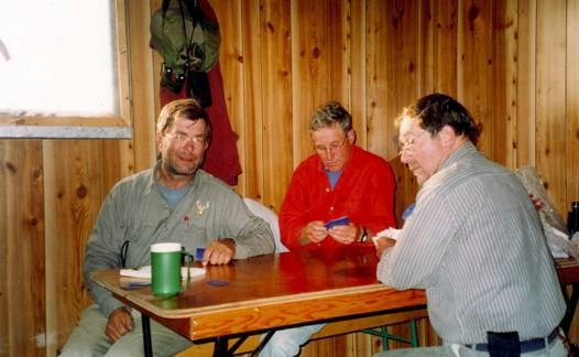
The abundant presence of the flies in the evenings eliminated any opportunity to sit around the old campfire and swap lies in that soft twilight of early July when darkness never comes. While the sun did retreat below the hills in the northwest by about 10.00 p.m., it never did get dark. And the sun could be seen raising its head again over the northeastern horizon by 4.30 a.m. Seven o'clock in the evening generally saw us in our tents simply as a means of protecting ourselves from the swarming hordes. As an after-hours diversion there were a number of games of hearts played along the river. In the early going this scribe effectively "cleaned their clocks". But alas, even the "slow" eventually learn, and with John's entry into the game they finally were able to contain the scribe's exuberant runs for control, and secretly gloated at putting him in what they considered to be his rightful place - the loser's column!
The Tundra:
I recall Bill coming down off one of the banks behind a campsite where he had been giving the tundra behind our new home an initial visual once over. In response to my question of "What did you see?" his one word cryptic answer of "More!" said all there was to say about the arctic terrain - it seemingly goes on forever. Visibility, even from the river, could at times be spectacular wherever there were hills. Two of the most dramatic locations from the water were the area east of the river southeast of Ursus Islands where one could not resist scanning the sides of the gently north-sloping hills to the southeast. A second location was to the north of the Ursus Islands where the elevation of the local, more rugged hills ran up to some 160 meters above the river. The perspectives in both areas were at least 15 kilometres in distance and were almost totally unobscured by any type of vegetative cover. Early in the trip we had tended to glass such areas for caribou, or perhaps wolves, but toward the end, when we realized that caribou were unlikely to show up, we simply gazed, drawn to their subtle beauty like a moth to a flame. The most prominent visuals on the open terrain were widely scattered individual boulders, and it took a day or two and a lot of binocular work before we could dissuade our overactive imaginations that the dark ones were not bears, nor the rare white ones caribou. Clumps of willow or spruce often marked low protected spots, and the odd patch of ice, still defiant against the summer temperatures, was seen at the foot of protected cliff faces. Occasionally it was possible to see the evidence of burrows or dens marked by the highly visible piles of extracted buff colored sand, and not infrequently, the patchy denuded top of a sand esker complex could been seen in the distance.
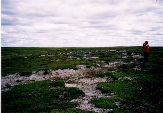
Wind-eroded Sand-rooted Tundra Vegetation
We explored several variations of tundra by foot, ranging from lower lying sand and gravel ridges, to somewhat more rugged boulder till ridges, to the highest and least common ridges, the tops and sides which were strewn with large, irregular boulders, often up to a meter in diameter. All these ridges were separated by low lying areas of mixed sedges, grasses, and willows, and frequently contained bogs, fens, black spruce swamps, and occasional ponds or small lakes. Interestingly, with the exception of some of the shores of the small ponds, the presence of permafrost gave most of the low lying areas a firm bottom covered by only a few inches of water or organic soil. The tops of sand and gravel ridges were generally characterized by patchy, vegetation-free erosional features sculpted by both wind and water and up to perhaps a meter deep in sand areas.
Their surface was usually characterized by the presence of stones and cobbles too heavy to be moved aside by the constant winds. The very tops of the ridges of finer grained detritus, particularly in the immediate vicinity of a good "viewing" boulder, were frequently marked by the presence of arctic ground squirrel burrows. Also occasionally evident in these areas were fissures in the ground-hugging vegetation layer marking the incipient development of polygonal ground features characteristic of permafrost terrain. West of Warden's Grove the sand hills above the shoreline on the south side of the river were only partly vegetated and gleamed white in the distance. Northeast of Hornby Point the hills for at least a distance of 15 kilometres showed a characteristic rocky till composition.
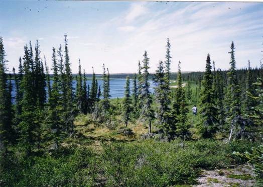
Black spruce was generally confined to the riverbanks and the protected valleys among the hills where soil and moisture conditions were better and the trees could better cope with the wind.
Black Spruce Stand Near Hornby’s Final Winter Campsite
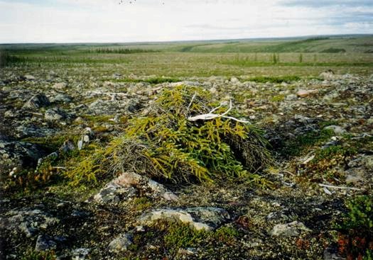
A Ground Hugging Black Spruce Forced to Seek Shelter from the Incessant Wind
Where spruce had tried to colonize the edges of the hills the trees might have originally sometimes reached five feet in height but those tops had succumbed to the elements, and growth had subsequently been concentrated within a half meter of the ground. The dead remains of the ground-hugging spruce had all the bifurcating contortions of a unique work of art.
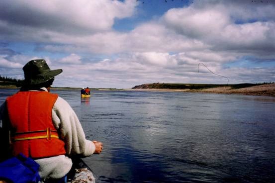
The Fishing:
The fishing was nothing short of spectacular! Bill, our most avid fisherman, was into it within an hour of setting up camp across from Warden's Grove and started the process with the first of several pike taken by he and Chris near the mouth of a small feeder stream. One of them conveniently provided our first fish breakfast. We saw our first lake trout the next day in the narrow channel immediately west of Cosmos Lake, and John caught the first grayling another 15 kilometres downstream at a pool created by significant narrowing of the river. A number of trout and pike were caught on the lazy "S" part of the river just downstream of Hornby Point, and one grayling at the mouth of the creek immediately across the river from Hornby Point. That particular grayling by the way was pursued twice, and once caught, by a large pike while it was being played in shallow water. Fortunately, the pike's grip on the smaller fish was less than adequate and the actions of the grayling and the fisherman to whom it was still attached were sufficient to secure his freedom. So deserving was the grayling's effort in the face of the toothy maw of that pike that he was returned to the water to pursue his future destiny.
Pike could almost always be caught in backwater areas. A pool at the end of an active riffle or at the mouth of a highly active incoming stream would likely hold one or more trout and usually also a pike or two. Trout would also occasionally be found in a couple meters of water along strait shorelines where there was noticeable current, and in a couple instances they were hooked in no more than 30 cm. of riffles within a half-meter of the shore. Because none of us had ever fished grayling, even thought Ray had had the desire since the age of 13 to intimately inspect that large dorsal fin, it took us about four days to feel comfortable spotting good grayling habitat. The secret we found to be riffles and moving water from a third of a meter to a couple meters deep. A meter or so of riffled water behind or below a gravel bar or string of boulders was almost always productive. It was also almost always possible to entice one or more from those areas of swiftly moving deeper water along straight shorelines, where they appeared to each have their own separate foraging areas.
Arctic pike are no different than their southern cousins and would hit on practically anything. We caught them on a variety of lures ranging from bucktail streamers and No. 1 Mepps-type spinners, to six-inch lake trout trolling lures. Bill again proved however that the best lure for pike, even in the Arctic, is still the old reliable red and white daredevil. Pike ranged from "hammer-handle" size through to many in the 15 pound class, and several of the smaller ones showed indications of having been mauled by their larger brethren. Bill simply couldn't resist trying for big pike when the trout action was getting slow.
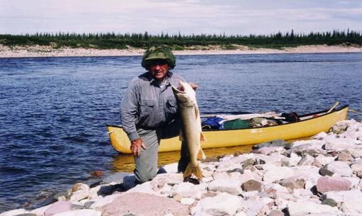
Lake trout were partial to Little Cleo spoons in a variety of colors, responded well to Bill's copper colored six-inch Finnish trolling lure, and could also be enticed to hit No. 1 Mepps, including black and yellow as well as red and silver varieties. The largest trout we caught was estimated to go at about 17 pounds and was caught on the Finnish "special". Ray caught a 15-pounder and a 9-pounder on a red and silver #1 Mepps, and a 12-pounder on a Little Cleo. The lake trout averaged three to 7 pounds, and appeared to have a head somewhat larger in proportion to their body than their southern cousins. The stomachs of a number of trout kept for food appeared to be empty.
Ray with a Large Lake Trout that Provided Supper
Yes, Virginia, grayling really do have a small mouth! As a result we fished them almost exclusively with #1 Mepps, the exception being the use of bucktail streamer flies. Ray found that the treble hooks on grayling lures proved to be a nuisance when releasing fish and clipped the extras off with pliers. Grayling appeared to be more sensitive to handling than the other two species, and we soon learned to release them as quickly as possible with a minimum time out of the water. They were scrappy fighters, particularly on light tackle, and would be a delight on a fly rod. Out of the water their color in July tended to be silver and no way near as intricate and intense as that displayed either in drawings, or by mounted fish where the taxidermist may have used a bit of artistic licence with the paint brush. The dorsal fins would on occasion, particularly as seen underwater, have more color, including blue spots and vermicular yellow lines. The grayling caught by our party ranged from about 30 to 40 centimeters with the largest going up to about 1.75 lb.
John and Ray spent most of their time concentrating on catching grayling and the trout caught were a bonus. Bill was the only one whose crank really turned with the opportunity to catch big pike. 'The Brit' was happy with what ever came along.
The Wildlife:
We entered on this excursion with the expectation of seeing caribou, many caribou as the Beverly herd is estimated at 350,000 animals. But like Hornby et al, we missed them! 1999 was simply not a good year for dancing with the caribou on the Thelon in July. We had seen two small herds of about 350 animals some 20 minutes south of the river on the afternoon we flew in. Copious hair at the waterline the following morning indicated that those animals had crossed the river above us during the long twilight that masquerades as night. Downstream we noted two other instances of caribou hair above the present waterline, one when the water was about a foot higher, the second when the water was about 3 feet higher, indicating earlier passage of animals across the river in June. The two parties preceding us down the river did not see any caribou, and the party that followed us saw only a solitary animal, so it was not a matter of body odor, or even the fact that we had
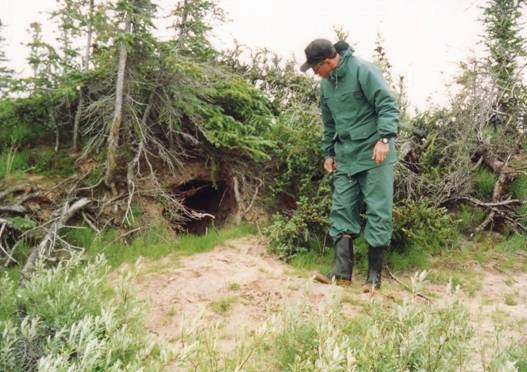
Bill Examining the Entrance to a Wolf Den in the Sandy Upper River Bank
the Queen's representative in tow. We were told when we arrived back in Yellowknife that the main portion of the Beverly caribou heard was still in the south near the tree line. Know one knew why!
Wolves were plentiful along the river, and practically every beach had its set of tracks. These wolves den along the river and prey on flightless geese that frequent its shoreline. We collectively saw 7 wolves over the 11-day period, three black and four white. Four of them were seen loping along the shoreline, and one just after having swum across the river. He stopped and watched us with canine curiosity for several minutes before edging off into the willows. Two others were spotted across the river against the sky on the top of an esker as we were setting up camp. The male lay down and watched us from his excellent vantage-point for an half-hour before finally disappearing with his companion over the lip of the hill. The last wolf we saw was actually engaged in hunting geese. We noticed the birds scattering in the air and on the water while we were still a good kilometre away and assumed they had spotted us and were exceptionally wary. The wolf spotted us at about the same time we saw him, and we each continued our vigil with appropriate curiosity for the next half-hour, he on his haunches on the beach, and we from a good vantage-point in our canoes 200 meters away as we drifted downstream. At one campsite we noted the telltale signs of a successful hunt by a wolf in the sand of the beach - the running tracks, the four-pawed screeching halt, and a patch of blood in the sand. The nature of the prey was not apparent as there was neither fur nor feathers associated with the sand picture. We had noted an abandoned wolf den about 100 yards away during the afternoon. That night some animal on the beach in the vicinity of our tent awakened Ray. A peek out the front of the tent toward the overturned canoe and the food packs 7 meters away discounted the presence of a prowling bear. Assuming the likely presence of a ground-thumping arctic hare, he went back to sleep. The next morning the fresh tracks in the sand within a meter of both tents told of a curiosity-driven visit from two adults and one young wolf during the night.
Moose were very common along the river; we saw seven - two bulls, four cows, and one calf. Their abundance is even more impressive in that the presence of moose on the Thelon was unknown prior to the early 1950's. Pellet piles abound in almost every substantial willow thicket along the river. We came across a number of discarded moose antlers, and their tracks were quite common on the beaches, particularly in the Ursus Islands area.
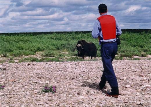
The Thelon Game Sanctuary was originally established to protect Canada's most southerly heard of musk oxen, and it has served its objective well. The herd has grown from and estimated 250 animals in the 1930's to an estimated 1100 at the turn of the millennium. We saw five, all solitary bulls as they had not yet commenced to build their late summer herds, and all on the north shore of the river where, for whatever reason, they tend to confine themselves. They were somewhat smaller than perhaps expected, very bovine looking in the snout, odiferous on the downwind side, and quite complacent, allowing us to approach to within 10 meters or less. The files were giving some of the individuals we saw a particularly hard time and the bulls would retaliate by bedding down in a willow thicket and continuously rub muzzle, face, and ears against the supple willow stems. Four of the individuals we saw were feeding, the other one lying in the breeze 10 meters or so from the river, close to cover. This was the only animal that retreated as we approached.
Bill and One of the Thelon’s Resident Musk Oxen
We saw three arctic hares, two of these on cobble beaches. They were larger than a snowshoe hare by half, were patchy gray and white, and were difficult to see on a beach unless they moved.
The smallest animal we saw was the ubiquitous arctic ground squirrel, or sik-sik. They are tawny brown with a black tipped tail, and are perhaps two and a half times the size of a red squirrel. They would be seen sunning or feeding near their burrows, and occasionally even running along the shoreline. They are a valuable food resource for the larger predators.
The rarest animal seen was a wolverine. John and Bill noted him suddenly appearing about 30 meters away in a hole near the top of the current-scoured face of a peat-rich island between Hornby and Lookout points. Unfortunately he did not elect to wait around while one of the guys retrieved a camera from his pack.
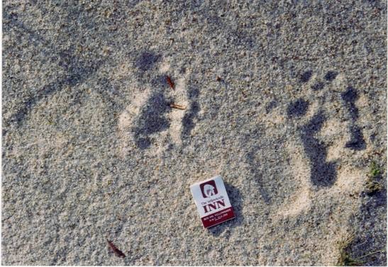
Perhaps the animal that was most discussed and not witnessed on the trip was the barren land grizzly. The grizzly is found along the river, and is not infrequently in contact with canoe parties. One had completely demolished the outhouse at the CWR cabin a few years past, and the logbook in the cabin cites several canoe party encounters with the animals. We debated the need for bear protection in the form of firearms prior to the trip. Kind words of advice from two differing sources of seasoned arctic travelers finally convinced us that we would be well advised to carry such protection, and this we did in the form of a 12 gauge pump shotgun, blanks, rubber bullets, and slugs. Three of us also carried bear spray. Fortunately we had no need for either. We did encounter fresh grizzly tracks - probably a yearling - on the beach at our campsite at Warden's Grove. We discovered later that the bear had followed the creek out to the beach the previous morning just as another party of four was loading their canoes. While the canoe trippers finished their packing and pushed off in record time, the bear wandered the beach for a few minutes and then swam across the river to the west side. We saw one other old track on a beach downstream about three days later.
Grizzly Tracks on the Beach at Our First Campsite
The Birdlife:
The most abundant birds on the river were Canada geese, and we probably saw close to 1000 over the 11 days of the trip. They appeared to be equally present as both juvenile non-breeders enjoying the pleasantries of a northern summer, and as breading pairs with non-flying young. It was noteworthy that they were extremely wary and would often flush at 500 meters, with the young and some non-flying juveniles making a quick getaway up the bank to the nearby willows. Some of the adults and juveniles had sufficient post molt feathers to allow them to fly, sometimes admittedly with a bit of a lack of grace, downstream and around the bends. Occasionally mixed in with the Canada were a few white fronted geese. They usually appeared as isolated pairs raising young on the river, and for the most part appeared somewhat less wary than their gray and black cousins.
Ducks were likewise common, but identification proved to be something of a challenge given their combined state of molt and wariness. Mergansers were perhaps the most widespread of the ducks, likely both common and red-breasted although we did not make a positive identification on the latter. We put up a couple flocks of scaup. Oldsquaw were noted in a couple small ponds a few hundred meters from the river. As for dabblers we saw blacks, widgeon, ring-necks, gadwalls, and a mallard. The first day on the river we came across one small flock of white winged scooters. From one to four whistling swans a day made their appearance, readily noticeable from a couple kilometres distance by their distinctive white plumage. They tended to be even more wary than the geese. Loons were noted most days. They were either red throated or arctic, but with a couple exceptions where the red throat was visible on an individual flying over the canoe with the sun in the right position, we were unsure of the species. Beverly Lake provided us with the one common loon of the trip. Arctic terns were common, and proved to be most accommodating to our presence, sleeping peacefully with us passing in the canoes or walking on land up to 10 meters away. One or two herring gulls made an appearance daily. Long tailed jaegers were seen twice (same flock?), once near Lookout Point and once on Beverly Lake where they flushed a rather large flock of unidentified shorebirds.
As for raptors we saw 4 eagles, an adult and an immature bald, a golden which flew directly over the canoe at about 50 meters, and one unknown soaring along the tops of some hills southeast of Thelon Bluffs on the last day. One pair of nesting merlins was noted upstream from Hornby Point. We saw several peregrines including at least one nesting pair, and several gyrfalcons both light and dark phase. In addition Ray convinced himself from the flying mannerisms of a pair of raptors seen through binoculars flying low over an arctic meadow that they were harriers.
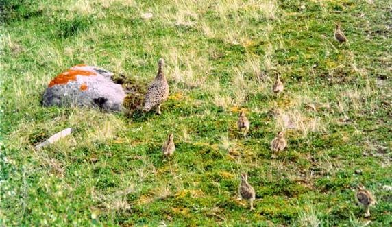
Mother Willow Ptarmigan and Seven Chicks at Beverly Lake
Mottled white and brown willow ptarmigan were common in and around camp, particularly at night when they made a rather bark-like call to maintain contact. From five meters we also saw one rock ptarmigan with 13 downy chicks out on a walkabout on a narrow sand beach, totally unconcerned with our presence until Bill's camera clicked, inducing them all to scamper away into the adjacent willow cover.
Identified shore birds numbered four species. The most common was the semipalmated plover; the lesser yellow legs was less common but noisier. We also saw two least sandpipers, and one lesser golden plover, the latter spotted standing motionless among the beach rocks while glassing for geese. Sandhill cranes were heard vocalizing twice.
Both cliff and bank swallow were noted in small colonies where appropriate nesting habitat was available along the river. One or two robins were seen every day, and we saw about nine ravens during the trip usually in singles or pairs, but including one threesome. One whiskeyjack called in the spruce near Hornby Point, and one horned lark was noted near the CWR cabin. As for the smaller birds we identified Harris' sparrows, tree sparrows, white crowned sparrows, white-throated sparrows, and a hoary redpoll. A number of other species of small birds were seen but not identified.
The Flowers:
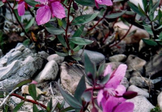
Flowers abound in great profusion along the Thelon in early July. Perhaps the most striking and certainly one of the most abundant was the four-petalled, magenta-flowered "River-beauty", a showy arctic relative of the fireweed with mauve bracts between the petals. It was, true to its name, found on active sand and gravel beaches for the entire length of the river. It would occasionally present itself in large clumps with a couple dozen of the large showy flowers making a simply gorgeous bouquet. The second most common and showy flower was the blue and white arctic lupine. It was first noted near the right angled turn in the river north of Hornby Point, and its presence continued on the higher levels of the beaches and into the moist tundra areas all the way to Beverly Lake. Labrador tea was in full bloom through out the trip. The dainty, mauve, low-lying moss campion was also found the full length of the Central Thelon but by mid-July
The River Beauty – A Variety of Fireweed
some of its beauty had begun to fade. Another visually striking flower was a yellow coreopsis that grew near or above the high waterline, singularly or in small clusters, the latter being readily visible for a half-kilometre distance. The furry white heads of cotton grass dominated the boggy areas. Other recognizable flowers: - a white variety and a light purple variety of vetch frequently present on the drier parts of the beaches; a short member of the buttercup family on the tundra above the waterline; carpets of paddle-shaped bearberries leaves awaiting the frosty mornings to turn them an intense deep red; the occasional blue columbine, a mauve lousewart, and a white everlasting. And yes, there was even one specimen of our old standby, the dandelion! Many other species were present but simply unfamiliar.
The Artifacts:
The presence of man on the Thelon is evidenced by his artifacts. Available artifacts denote both 20th century usage of the valley, as well as prehistorical usage which the experts indicate ranges back in time to about 7000 BC.
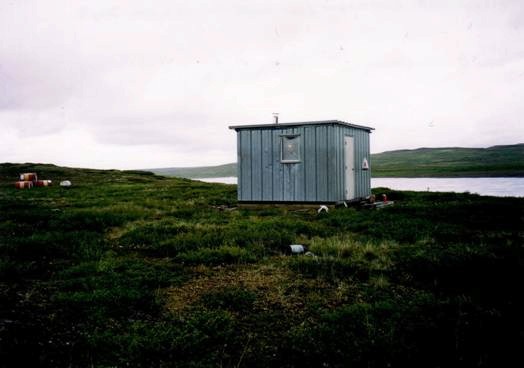
Of the more recent artifacts the cabins at Warden's Grove and upstream from Thelon Bluffs, and the grave sites and deteriorating cabin at Hornby Point (which we were not able to locate!) are probably the most prominent.
The Canadian Water Resources ‘Cabin’ about 40km West of Beverly Lake
The Palatial Interior of the Canadian Water Resources ‘Cabin’
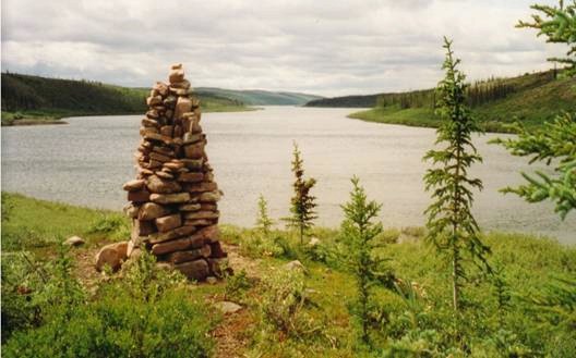
Of secondary significance was a substantial and prominent two meter high cairn, constructed in 1963, of semi-rounded boulders and cobbles and located on a prominent gravel ridge on the east side of the river about 20 kilometres downstream from the mouth of the river emptying Cosmos Lake. A plastic bottle with several notes from passers-by going back to 1992 was cached in one of the holes near the base, including one from a party passing-by a few days before our arrival. Unfortunately the bottle showed clear evidence of having been explored by grizzly teeth and the contents were wet and not easily readable. Across the river, and perhaps a kilometre inland against the skyline on a prominent ridge, there appeared to be a second manmade rock edifice but it lacked the elaborate form and structure of the riverside cairn. Although we had lunch at the site, for whatever reason we had no compulsion to leave a message.
A second cairn was located about a kilometre inland from the river on the highest of a series of low gravel ridges on the west shore of the river about 10 kilometres upstream from Lookout Point. Constructed of quasi-flat sandstone boulders, the cairn had unfortunately collapsed to a pile of rock rubble because of poor construction techniques. The purpose of the cairn was not immediately apparent. Ray left the site with the decided impression that the "contractors" had likely been a group of boy scouts who had camped nearby and had used the project to burn off some extra energy during the long arctic evening.
There were two additional evidences of man's recent but less than appropriate use of the area. The first was the presence at the high water level of some four, 45 gallon gas drums that appeared to have been washed downstream from a former cache, perhaps from the area of Cosmos Lake where they were left by the military in its search for remains of the Soviet satellite Cosmos 954, the larger pieces of which crashed to earth in 1978 in the vicinity of Cosmos Lake. A fifth drum was seen well above the high-water line and appeared to have been cached to supply a helicopter survey and had never been retrieved. The second instance involved two rotting tin cans at the foot of a 10-meter bank below a small tent ring and fireplace on the flat top of the bank overlooking the river. The campsite looked to have been at least several years old.
The Prominent Cairn on the South Shore 20km South of Cosmos Lake Stream
One last "artifact" requires mention. On a low tundra hill about 500 meters north of the river in an area with no distinguishing marks, Ray found an irregular piece of glass lying on the ground-hugging vegetation. It was about 15 mm by 7 mm, and ranged from 1.5 to 2 mm thick. Pale green in color, the glass had sharp edges, displayed a conchoidal fracture, and contained faint internal "lines" not unlike those that were common on window panes from early in the century. Its source was not apparent and there was no other glass in the vicinity. It may have been part of a window of an early cabin on the Thelon, deposited in its resting-place by a collector raven intrigued by its shiny nature. The quality of the glass looked to be too substandard for it to have been a fragment from an instrument panel of the Cosmos satellite, the scattered remains of which were centered about 100 kilometres to the southwest.
Prehistorical archaeological remains are common along the Central Thelon. Fifty-two sites have been located between the Hanbury-Thelon junction and Hornby Point, with the best-studied site located on the ridge across the river from Warden's Grove. The artifacts found in the Thelon valley are representative of at least five distinct cultural groups, both Indian and Inuit, dating back to at least 7000 years BC.
River terraces, representing former beaches, along the Thelon, although occasionally discernable, are poorly and only intermittently developed. This suggests those post- glaciation water levels likely dropped quickly to approximately present day levels. Although we casually looked for signs of early man's presence on the plateau above the riverbank in several places, we only had success in one location.
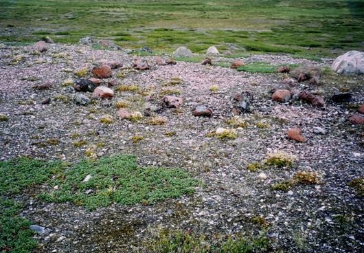
One of the Several Various Sized Tent Rings on the Knoll West of the CWR Cabin
Scattered over the tops of several the rounded hills immediately west of the CWR cabin are at least a dozen (I don't know why I didn't count them, I counted everything else!) tent rings ranging from 3 meters to 9 meters in diameter, with the average diameter being about five meters. A few of the older rings had been cannibalized to provide material for later rings. One would anticipate the smaller rings may have represented a couple hunters, the medium sized rings a family, and the two or three larger rings an extended family. Some of the tent rings appeared to have associated with them small rock fire pits, a characteristic of which appeared to be the placement of a flat rock within the center of the fire pit, likely used as some sort of a warming stone. This site has been elsewhere identified as an "old Inuit camp".
These hill tops were used as a campsite for two reasons, i) they provided the hunters with a good vantage point from which to search for the caribou herds that crossed the river at this location, and ii) the elevation provided good exposure to the wind which was a deterrent to the constant flies of early and mid summer. That the caribou use this area as a crossing is evident from the numerous well-worn trails on the opposite riverbank.
Also associated with the site were a number of agglomerations of small white quartzite flakes, which appeared to represent the detritus from stone tool knapping. No unmistakable tools or hammer stones were noted, although one worked piece of quartzite gave the appearance of being an incipient spear point which had broken and been discarded by its artisan.
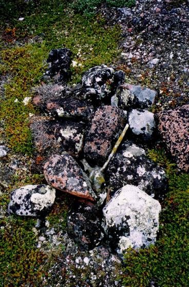
Of significant interest was the presence of a badly deteriorated, lichen-encrusted caribou skull, including antlers, which had been buried under a pile of cobbles and boulders. The time of and reason for its burial was not readily apparent. The fact that the skull was now partly exposed may have been due to the work of animals just subsequent to burial, or may simply reflect a poor burial initiative, intended or otherwise.
A Lichen-encrusted Caribou Skull in a Stone Cairn
Present on two locations on the west facing edges of the hilltops were low agglomerations of boulders that looked to have been intentionally constructed. It was easy to visualize them as cover for one or two hunters, armed with either spears or bows, waiting with growing anticipation for one or more of the animals they first saw a kilometre away across the river to come within range.
The Finale:
Our last day on the Thelon saw us with a required paddle of about 40 kilometres to get us to what Ray dubbed as "Pick-up Bay" on the southwest end of Beverly Lake. For the first time in 10 days we had the wind at our back and the 'gettin' was good. We stopped at the Thelon Bluffs for a couple photographs, shipped
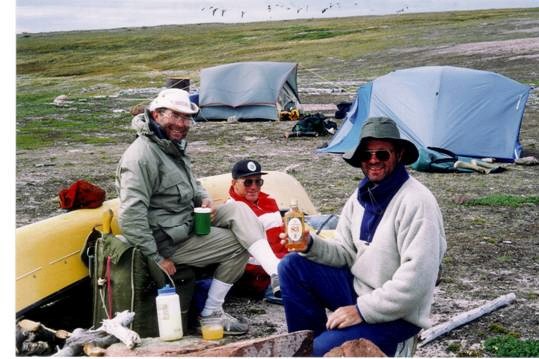
Saluting Long-time Friend Gerry O’Reilly at the Final Campsite
some water when we miscalculated and hit a couple standing waves, watched an eagle lazily soar along the ridge tops to the south and a wolf who had been unsuccessful in his hunt for a goose lunch. John caught a trout for our last supper, and by 1 p.m. we were having lunch at the entrance to Beverly Lake. After lunch with the wind at our back we set off from Hoare Point for the mouth of Pick-up Bay, rounding the point some 50 minutes later. By 4 p.m. we had our campsite established and were saluting the gods, our ancestors, and Gerry O'Reilly with our last happy hour.
At about 7.30 p.m. we used up the last of the charge on our satellite phone battery to inform the outfitter's base at Whitefish Lake that we had arrived at Beverly and were interested in the ETA of tomorrow's pick up aircraft. Just before the phone went dead the other end was heard to say that the plane was gassing up at this very minute and would be in for the pick up at………! That information forced some rethinking of our plans for the evening and we packed up all the loose gear but left tends up and bedrolls out - most of us had at one time or another torn down camps in anticipation of aircraft arrival only to have to set them up again when the aircraft did not show. But, as promised, the Beaver did arrive and at 10.40 p.m. landed in the bay, the pilot skillfully sailing it backward with the wind to put its floats up in the shallow shoreline of the gravel point.
We had a new pilot, our former captain having found "something better" in Edmonton. Mark from Bolton, Ontario had returned late from a winter on the beach in the Caribbean, and had just arrived Yellowknife the day before to take on the flying responsibilities for our outfitter. We were his first paying passengers in his new job. His politeness and assistance in getting the gear loaded on the plane were positive, and we found out that he had been flying for four years, initially with a regional airline out of Winnipeg, and latterly for a five star tourist camp in northern Manitoba.
We left Beverly Lake at 11.20 p.m. and headed west against a moderate headwind that increased our flying time by about an hour. The visibility was good in the mid-summer twilight and we were able to spot several familiar landmarks on the river as we followed it on the return journey. At Warden's Grove we turned southwest and another hour saw us landing at the camp on Whitefish Lake. It was then 2.15 a.m., yet there was still sufficient light to allow us to fly.
After a short sleep we left the Whitefish Lake camp at about 6 a.m. and continued west, again with a strong headwind, toward the gas cache at Reliance on the east end of Great Slave Lake. Becoming airborne after gassing up, the pilot pointed the nose toward Yellowknife. The headwind picked up significantly across the east arm of Great Slave and our air speed settled into the low 60's. In order to increase our forward progress the pilot took the Beaver up through a hole in the patchy cloud cover to about 5,000 feet, where our air speed immediately improved to average in the high 80's. We dropped down to about 2,000 feet about 20 minutes out of Yellowknife, and proceeded directly into the Old Town base. The gauges showed about six gallons of fuel remaining and suggested that the higher elevation maneuver had not only allowed us to reach Yellowknife sooner, but also had likely prevented a forced landing due to fuel starvation.
Our Buddy “The Brit” at the Gas Cache at Reliance on Great Slave Lake
The Postscript (There should always be a postscript!):
1) Lessons learned:
· 1:250,000 scale maps are suitable for navigation on the Thelon, but they require frequent visual confirmation of position during the day or daily confirmation by the ancillary use of a GPS.
· Tents to be used on arctic adventures should be designed to withstand significant wind stress.
· The flies will be bad! Ensure you have a head net and plenty of fly repellant. The blast from an aerosol can of Raid will work wonders to eliminate the flying hoards in the tents.
· The use of local wood as a cooking fuel is a reasonable possibility across the central part of the Thelon, but requires some daily management on the downstream end to ensure its ready availability.
· The Thelon can also be accessed readily from Fort Smith.
· If you are tired of wet feet, rubber boots do indeed make suitable canoe footwear. And you are allowed to ignore the yuppie smirks, at least you have dry feet!
· Bear management needs to be given careful consideration both prior to and during the trip.
· The iridium satellite phone (include extra, charged batteries), although somewhat more expensive to lease, has the most efficacy as a means of emergency communication.
· Carry pliers for removing fishhooks, and use single hooks, and going barbless is OK!
· You will see wildlife, but the caribou might not come!
· Take binoculars, take antihistamines, take frequent walks on the tundra.
· Distances are always greater than they appear to be.
· On the Central Thelon thirty kilometres a day is not an unreasonable distance to travel.
· 'Brits' can survive the Thelon experience, and with class!
2) The Beaver, which provided our access and egress, was "totaled" as a result of a miscalculation in take-off distance two days after returning us to Yellowknife. The pilot and four passengers walked away with bruises and one broken nose. By Sunday night I had two phone calls wondering if we had shared the experience. The world of bush flying in Canada is small!
3) For further reading: Thelon – A River Sanctuary by David F. Pelly; Canadian Recreational Canoeing Association, Merrickville, ON, 1996
RAR 99.08.17
|